



Digital Twins
How can we use AI-driven digital twins to understand cities?
5 min
In this story, we explain how digital twins can help us simulate the complex dynamics of real cities and use them to address major urban challenges.
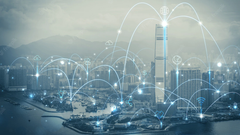
It’s not simply a nice 3D city model. It's a dynamic digital representation of the real environment connected with different data sensors, different data sources and models.
We can use it not only to see the city, but also to understand, simulate and predict what can happen in it.
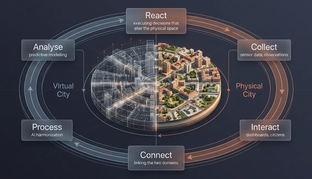
To create such complicated systems that are at the same time operational and easy to use, we need multidisciplinary collaboration and partnerships.
How do we do this?
We first consult the stakeholders for their needs and problems. Then, with students and colleagues, we develop open-source digital twin systems based on the latest innovations in the field.
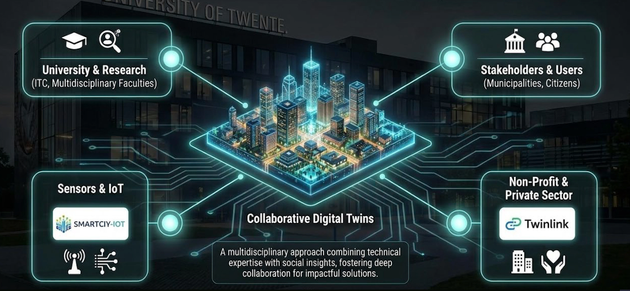
We also collaborate with companies like Smart City IoT because they install the necessary sensors on the ground to establish a real-time data connection between reality and the digital model.
With the help of non-profit organisations such as Twin Link, we can provide long-term maintenance and support to the stakeholders after we deliver our solution.
Cities are living systems that are continuously changing, but they are still managed by rather static tools.
Cities face increasing pressure from extreme heat, floods, energy demands, mobility, and other challenges.
But our planning tools often don’t capture these dynamics.
So far, we have developed digital twin systems for multiple domains, as in the picture below.
We have been working with municipalities in the Netherlands, such as the province of Overijssel and now Nijkerk Municipality. We also work in other countries both in and outside of Europe.
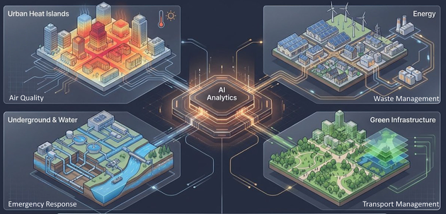
Time-series models (LSTMs) and Generative AI allow planners to test 'what-if' scenarios, forecasting the spatial consequences of policies across all domains
Digital twins continuously receive information from the real city. Their analyses allow us to test different scenarios. So we connect what is happening now with what could happen next.
And with this, we can ask different questions.
What happens if we change the land use here? What if we add more buildings, trees, solar panels, gardens or parking lots? How would that affect mobility, CO2, energy use, urban heat or air quality?
We usually use Multi-Criteria Decision support systems. We also provide cost-benefit analysis and print or visualise multiple solutions to make comparisons.
We can integrate a chatbot that can answer your questions, such as:
“Where am I allowed to build a house?”
“How much energy is my house using?”
“How much energy will we spend next year?”
Today, these domains are usually managed separately, but the city doesn’t work in a separate system. Everything is interconnected. That’s why we are working towards a common technical foundation where different domains can be connected, simulated and analysed together.
This is not easy, but the important point is that we are developing all this together with you.
If you’re interested in working with us or would like to develop a new digital twin application together, I invite you to contact me: m.n.koeva@utwente.nl
Login and start learning!