


Climate Change
How do you measure drought from space?
6 min
We explain how satellites can help us understand vegetation, and how this is used in models discussed at the COP31 climate summit.
A meadow that still looks green from the road can have been thirsty for days. Plants give that away in light the naked eye cannot see. A European satellite has been circling the Earth since this week, measuring exactly that light, and part of the research behind it comes from Enschede.
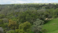
A leaf captures sunlight to make sugar. A small part of that light goes unused, and the plant emits it again. That faint glow is called fluorescence, and it is a direct measure of how hard photosynthesis is working. A plant with too little water stops photosynthesising before its leaves change colour. The amount of fluorescence therefore drops earlier than the green colour an ordinary satellite image shows, sometimes days earlier.
Fluorescence can therefore serve as an early warning. You do not see that a crop has been damaged, but that it is about to be. For a farmer or a water authority, that is the difference between stepping in and clearing up.
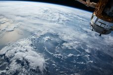
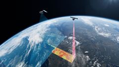
On the night of 15 September 2026, a Vega-C rocket carried the European satellite FLEX into space. From an altitude of 814 kilometres, FLEX measures the fluorescence signal of plants. The mission turns that into maps with cells of 300 by 300 metres, across the entire world.
The signal is extremely weak. For years it could not be measured at all. It amounts to a fraction of the light a leaf gives back, recorded straight through the whole atmosphere. Correcting for that is a craft in itself. Christiaan van der Tol makes that translation. He builds the models that turn raw radiation into something researchers and water managers can work with.
The Netherlands receives more rainfall on average than it used to, while its groundwater level is falling. That sounds contradictory, and the explanation lies in what happens to the water once it has landed. Warmer summers evaporate more of it, through the soil and through the plants themselves. About half of all the solar energy the Earth absorbs goes into evaporating water.
"We know that it rains more in the Netherlands and that the groundwater is still dropping. That difference is evaporation, and evaporation is precisely the hardest thing to measure with your feet on the ground. From space you see it across an entire landscape at once," says Christiaan.
So anyone who wants to know how much water will remain available cannot rely on the rain gauge alone. They also have to measure how much goes back into the air. On the ground, that is almost impossible. From space, it can be done.
Cloudy weeks produce no image, and the Netherlands has plenty of those. Scale is a limitation as well. One pixel of a satellite image easily covers more than a single field. What you see is an average of ditch, crop and verge mixed together.
That is why soil moisture sensors sit in farmers' fields in the Dinkel valley. Those measurements calibrate the view from above and fill in what happens half a metre below the surface. Satellite and sensors complete each other. The combination gives a farmer something usable: the water balance of their own field instead of a national average. From the same measurements, the water authority gets a picture of the entire catchment.
In November, countries meet at the COP31 climate summit in Antalya, with a preparatory meeting in Fiji and Tuvalu. Underneath almost every proposal on the table, there are climate models, and those still differ considerably.
One of the largest uncertainties is how much carbon vegetation absorbs, and how that shifts during a drought. The FLEX satellite passes over the same piece of the Earth a few times a month, which is too little to check what a country emitted on a given day. It is more than enough to see how seasons and droughts affect photosynthesis across entire continents.
Checking emissions is the job of a different set of satellites. The European CO2M mission will map human-made CO2 emissions, with measurements that can be placed next to the figures countries report. FLEX delivers the piece before that: understanding what the vegetation itself is doing. So there is no single satellite that provides the answer, but a series of missions that fill in each other's blind spots.
For a farmer in the Dinkel valley and for a climate model in an IPCC report, the gain comes down to the same thing: seeing earlier when a landscape is going thirsty.
Earth observation is the field of the ITC Faculty in Enschede. Research into water, drought and climate comes together at the University of Twente in the Climate Centre.
Header image: Flex in tandem with Sentinel 3-C ©ESA
This story has been republished with permission from UT Stories. You can read the original story here on the UT Stories website.
Login and start learning!