UAV
UAVs for Rubber Plantation Monitoring in India: A Tailored Training at ITC
Learn how ITC instructors taught a remote sensing scientist to use UAVs to monitor the health of rubber plantation crops in India.
Natural rubber is an industrial raw material in constant demand. With applications ranging from car tyres to construction, healthcare to footwear, defence, and transportation, the worldwide demand outpaces production.
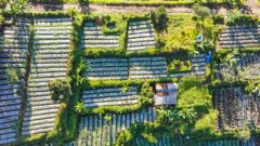
90% of global supplies of rubber are produced in Southeast Asian nations. And in India, the industry provides direct and indirect employment for millions of people. Most of the rubber plantations in the country are small-scale holdings.
Rubber is produced from rubber trees, where latex (a milky sap) is tapped from the bark and collected for processing.
The rubber plantations in this part of the world, however, are vulnerable to several factors, including climate change and diseases.
Rubber plantations are affected by diseases such as Abnormal Leaf Fall (ALF), Colletotrichum-related leaf infections, Pestalotiopsis leaf fall disease (PLFD), etc. Typical signs of these diseases include round lesions on leaves, yellow discolouration, leaf fall and premature leaf drop, all of which can reduce the chlorophyll levels in the foliage. These diseases lead to yield reduction and have caused a substantial economic impact for smallholders in Southeast Asian countries.
With this in mind, Pradeep Balan - Remote Sensing scientist at the Rubber Research Institute of India (RRII)- saw a need for the monitoring of their crops using UAVs.
The RRII is located 8 kilometres east of the town of Kottayam, in the state of Kerala. Established in 1955, the institute operates under the Rubber Board at the national level under the Ministry of Commerce and Industry.
Whilst attending a course on biomass, forest resources and climate change at ITC, Pradeep proposed a list of topics from the RRII for a tailored-made training. As well as the 3D modelling of canopies, the RRII was also interested in analysing them.
With a crucial intake meeting to understand needs and expectations, the ITC then adjusted these according to what they could offer.
The topics having been decided, the training took place from 25th April to 7th July 2023. Pradeep’s main instructors were Florian Ellsäßer and Panagiotis Nyktas, both Assistant Professors at ITC.
While Florian’s focus is typically on agricultural applications of technologies, Panagiotis, on the other hand, usually studies natural trees and forests. They immediately recognised the immense potential: because Pradeep’s work at the RRII concerned a tree plantation, his training requirements perfectly combined both of their areas of expertise.
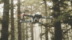
A key aspect of the training was homing in on the techniques and technology that were best suited to Pradeep and the RRII’s needs. This included determining the kind of UAV that was best – whether fixed-wing, rotor, vertical take-off and landing; what kind of sensors would be needed (e.g. RGB, multispectral, thermal, LiDAR, etc.), and how to make a flight plan, using software tailored to his specific needs.
Panagiotis, who focused on helping Pradeep with flight planning, data acquisition and Structure from Motion (SfM) processing, emphasises that it’s important to tailor the workflow to the use-case for efficient data capture and to avoid creating unnecessarily large datasets
Panagiotis further explained the components of multispectral sensors, why and how radiometric calibration with a reflectance panel is performed, and how vegetation indices help detect suboptimal vegetation conditions due to, e.g., pests, diseases, or nutrient deficiencies.
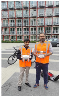
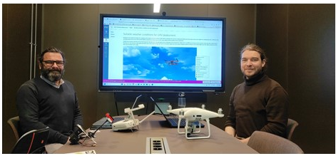
(Left picture) Pradeep and Panagiotis get hands-on with the UAVs; (Right picture) Panagiotis and Florian at ITC
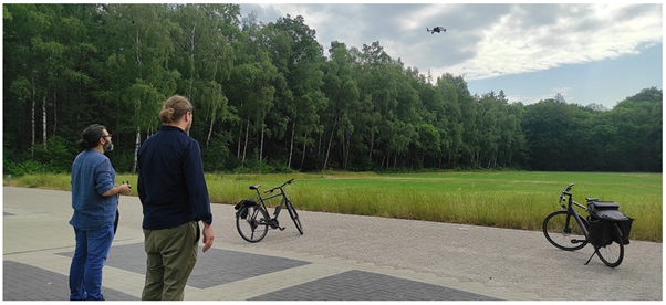
Panagiotis and Florian demonstrate flying a UAV at the University of Twente campus
As well as monitoring the impact of disease, one of Pradeep’s goals was to be able to count how many trees are in the plantation, which Florian helped with using a watershed segmentation approach on high-resolution canopy height model (CHM). In this approach, the raster is conceptually ‘filled’ until local maxima or basins define individual tree crowns.
Florian and Panagiotis also took Pradeep to the dedicated area on campus where there is space to fly a drone. Here, he was shown some of the different sensors available and what they can do. Learn more about different drone sensors with this Geoversity article.
Throughout the training, it was important for the instructors to be mindful of the differences that can occur between the training and the implementation, once the trainee is back in their home context. The trainers may make use of proprietary software, for example, or highly specialised knowledge. Or, in Pradeep’s case, the implantation of UAVs at the RRII ran up against national regulations: the training at ITC used DJI drones, the use of which is restricted under Indian law. The price discrepancies between drones purchased in Europe and India, in addition, can be massive.
Despite these constraints, Pradeep extended his deepest thanks to his instructors at the training’s conclusion, calling it “a truly valuable learning experience.”
Once back in India, Pradeep got to work securing funding for the purchase of made-in-India multispectral drones, as well as a license to process the data.
At the RRII, the institute now has an approved programme called Feasibility Studies on the Applications of Unmanned Aerial Vehicles in Rubber Plantation Management, with the aim of standardizing the use of UAVs in rubber plantations.
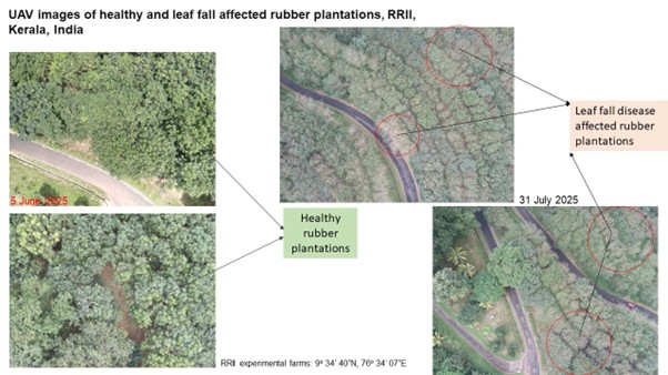
This is a phased research programme that has begun feasibility studies on the mapping of leaf fall diseases. Preliminary mapping, using time-series comparisons taken in June 5th 2025 and 31st July 2025, shows the impact of leaf fall diseases affecting the rubber plantation (see pictures below).
The institute is looking to explore the relationship between spectral indices and the leaf fall diseases, trying to quantify the relationship between the two.
According to Pradeep, the RRII have also developed some canopy height models for rubber plantations – “ that is very promising because we can estimate the canopy height and ultimately we can go for the biomass and carbon estimation.”
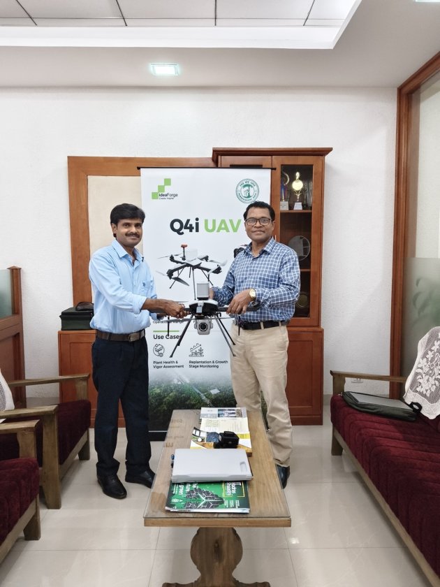
Pradeep (left), with the RRII Director (right), displays a multispectral camera implemented at the Institute.
Pradeep says that, while the RRI has not yet attempted to implement more advanced techniques, they’ll be looking into using machine learning for analysis and developing more models for near-real-time leaf disease, as well as rubber yield prediction using spectral indices.
Login and start learning!