






Remote Sensing
Earth from Space: Typhoon Surigae
4 min

This week we look at a false-colour image showing the sea conditions as Typhoon Surigae passes over.
We are used to seeing satellite images of tropical storms from above the clouds, featuring the characteristic white swirls around the eye of the storm.
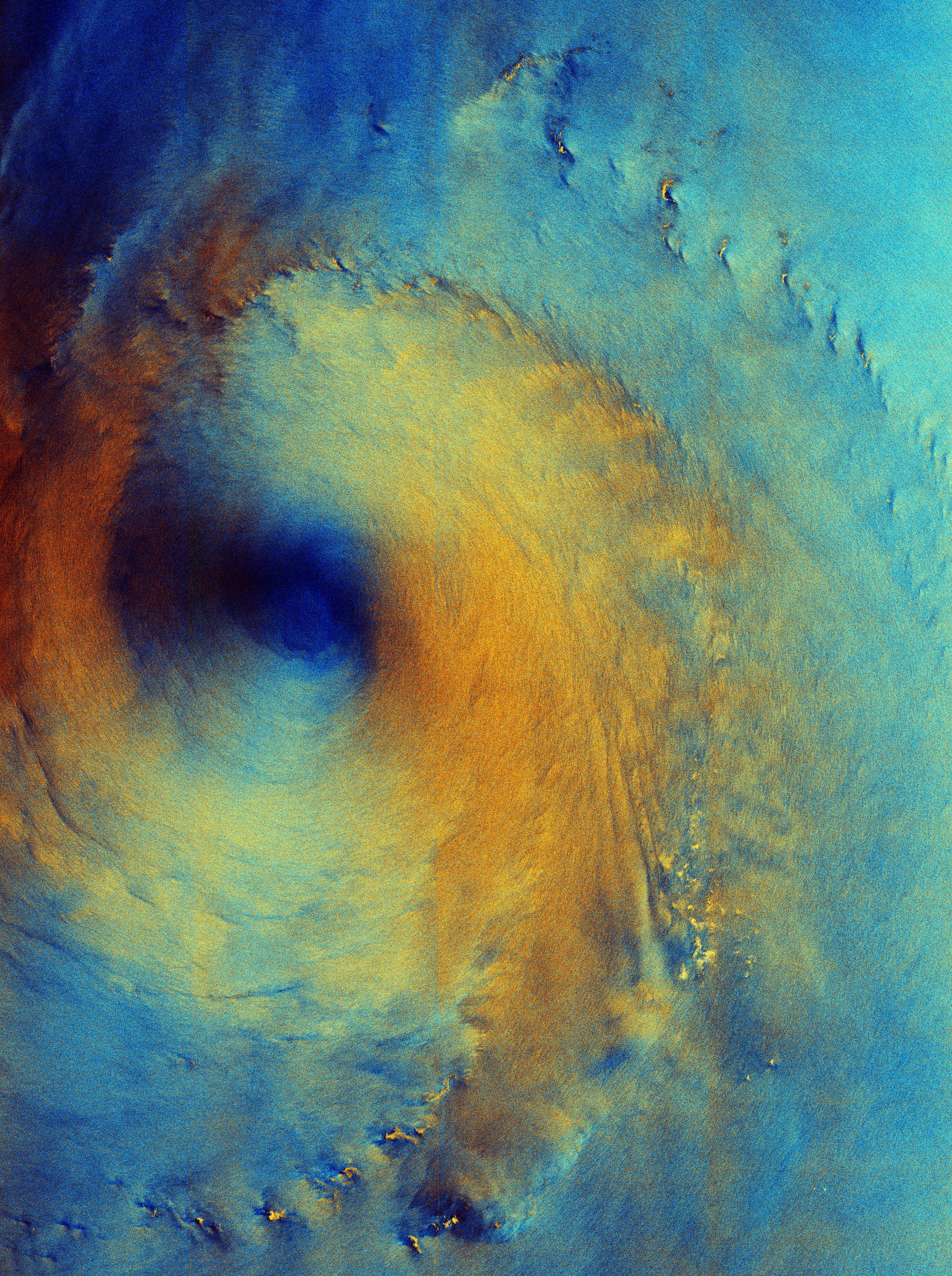
This false-colour, polarised image from Copernicus Sentinel-1 shows us the surface of the sea beneath the clouds, as seen by the satellite’s radar instrument. The sea conditions reflect the strong winds as Typhoon Surigae passes over.
Click below to enlarge or download the image:
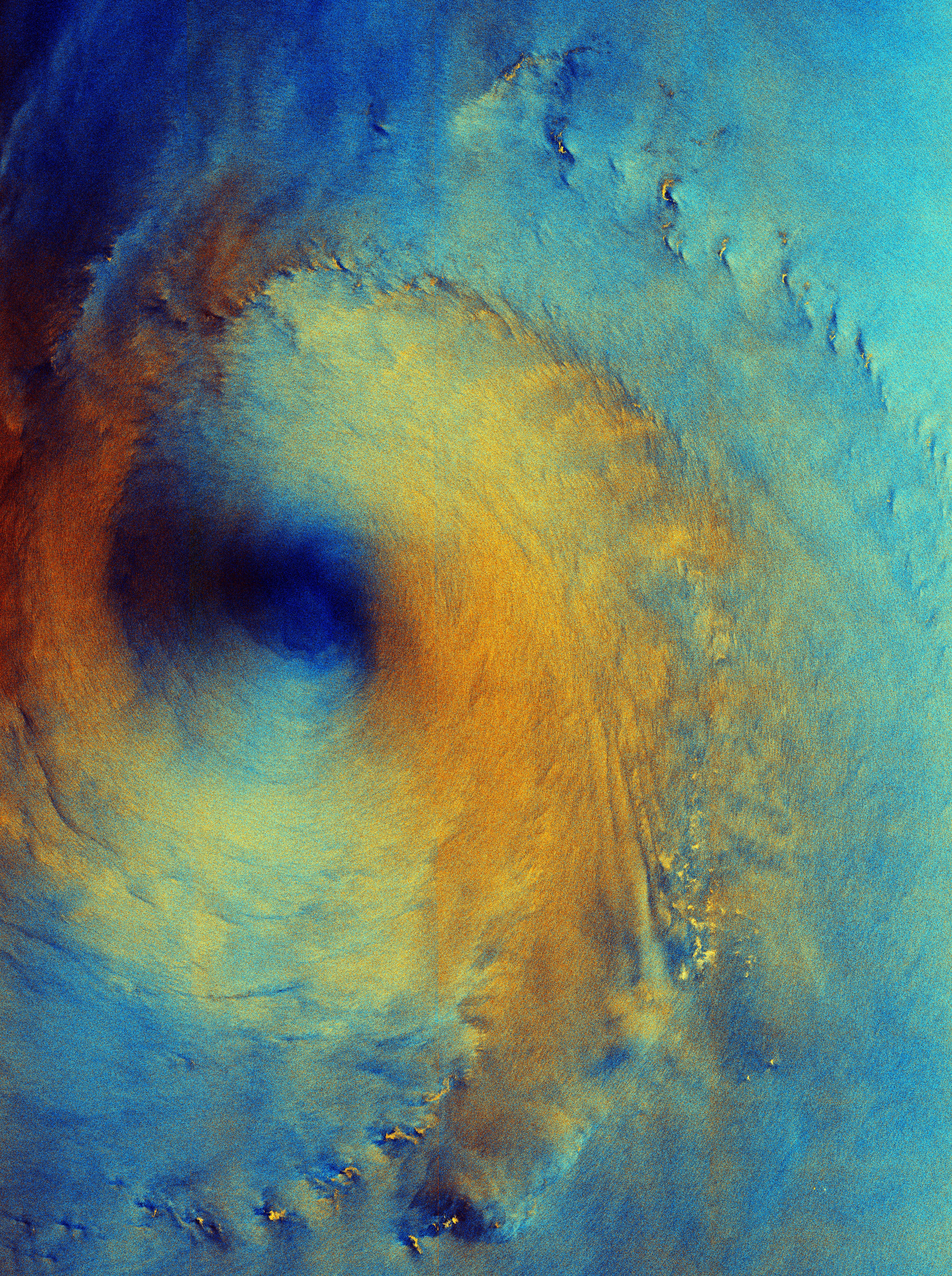
The image, captured on 28 September 2026, shows Typhoon Surigae as it was moving north-eastwards in an area of the Philippine Sea about 200 km south of the island of Shikoku, Japan.
By 1 October, the storm, also known as Typhoon no. 26, was almost 1000 km away, roughly 200 km south of Tokyo. It is one of several typhoons in the Pacific Ocean at the moment.
The relatively calm seas at the eye of the storm are clearly visible in dark blue in this image. The colourful effect is created using two radar polarisations, each assigned to a different colour. The orange-yellow ring in the image is where the radar instrument has detected rough ocean conditions and strong winds.
The lighter blue areas of the image show where the radar has detected a different kind of signal and it most likely denotes ocean and wind conditions that differ from the bright yellow and orange areas. Some of the possible causes are lower wind speeds, less sea surface movement or areas of rain.
Some bright yellow flecks are seen in the lower part of the image. While these look like small islands, there are no land masses in that region – they are most likely to be areas of concentrated wind and rain.
When this radar image was acquired, Typhoon Surigae had strong winds with maximum gusts of up to 240 km per hour, with dangerous ocean conditions including strong swells and waves reaching up to 7 m.
Since then, it has weakened considerably and is currently classed as a tropical depression, with maximum wind speeds of 55 km per hour.
Login and start learning!