






Water Resources
Earth from Space: Danube’s waters fall to record lows
3 min

This week we look at two images demonstrating the impact of drought and heatwaves in Europe.
These Copernicus Sentinel-2 images show a stretch of the Danube river about 45 km north of the Hungarian capital, Budapest.
Click below to view the two images.
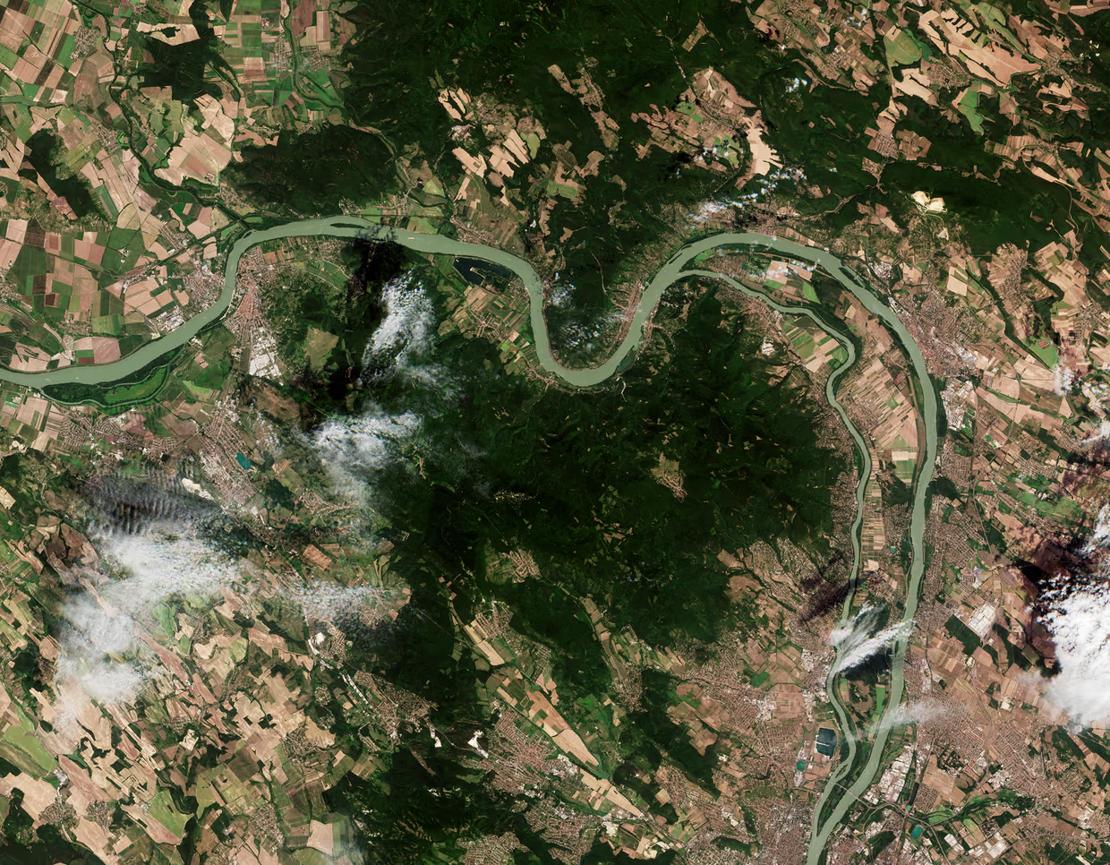
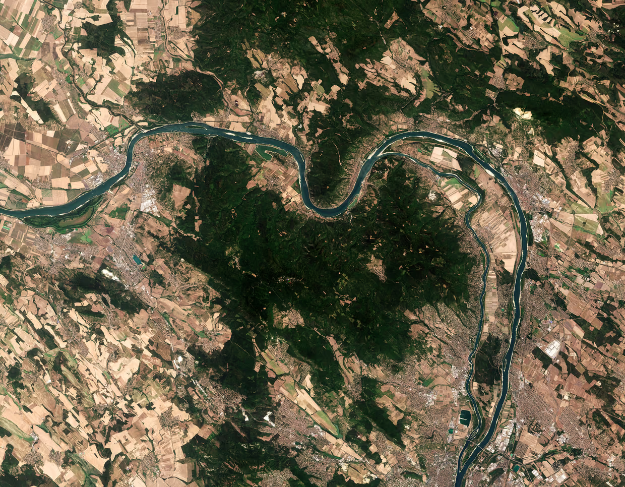
On the left is a satellite’s view from 9 August 2025, showing the river running through a summer landscape, with both yellow and green fields. The image on the right shows the same stretch of river on 4 August 2026, where the level of the Danube is noticeably lower, with visible sandbanks and surrounded by much drier countryside.
The river’s level has fallen to a record low in Hungary due to a severe drought in central Europe. However, drought and heatwaves have become a perennial phenomenon as record low water levels have been recorded in the Danube since 2018.
This year, the Danube’s low waters have caused energy and water shortages in and around Budapest as well as problems for river barges and ferries. The low levels of water also impact wildlife, with fish unable to survive as water temperatures and pollution concentration levels rise while oxygen levels decline.
The Danube is the European Union’s longest river and flows for 2860 km from Germany to the Black Sea. Record low levels have also been reported in Romania.
Read here for more Earth observation images showing the effects of extreme heat in 2026: Wildfires, drought and extreme heat, 2026
Login and start learning!