





Disaster Risk
Anak Krakatau eruption by Sentinel-3
3 min

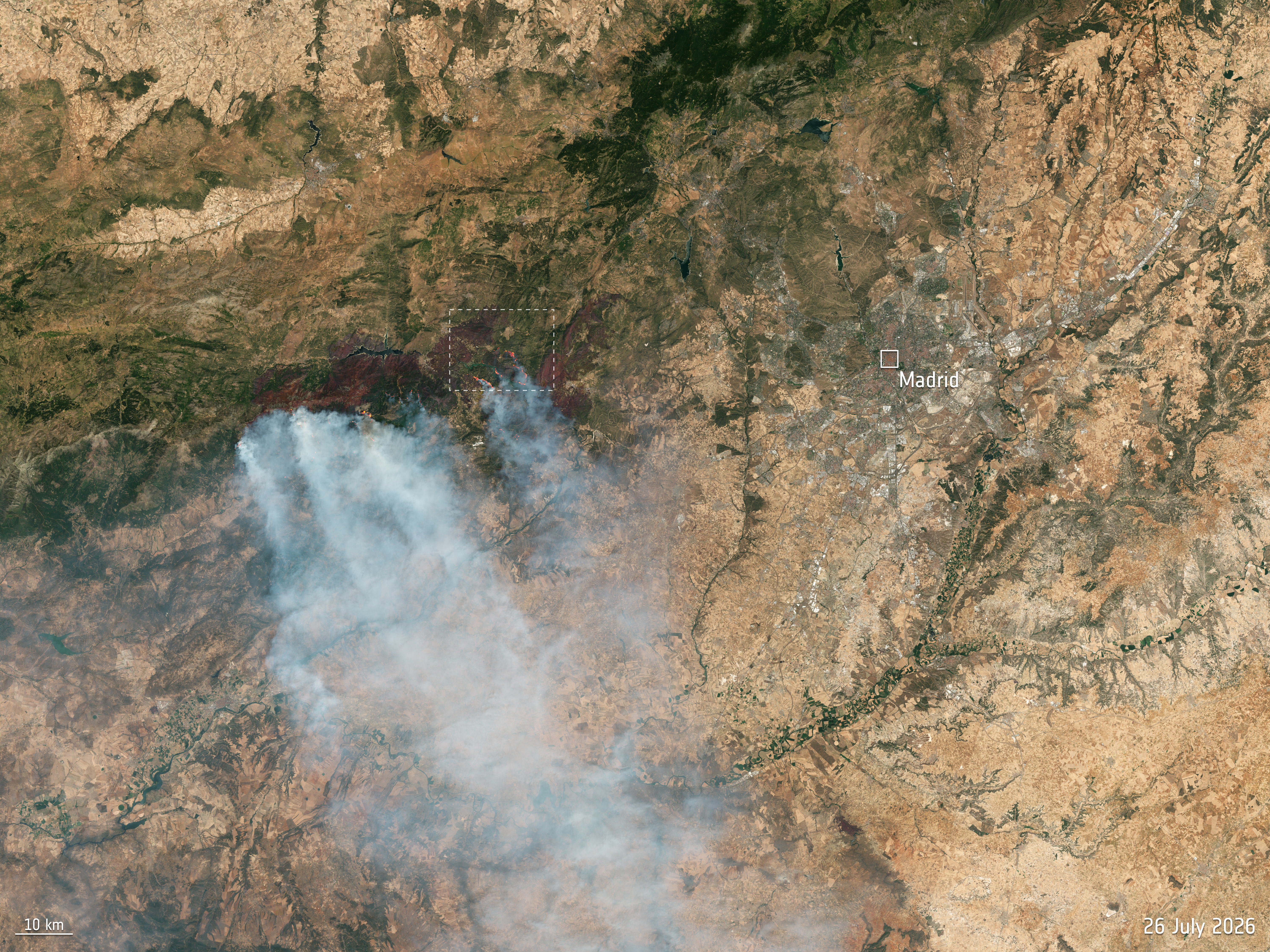
This week we use satellite images for a wide view of the wildfires currently burning near Madrid.
This Copernicus Sentinel-2 image, captured on 26 July, shows a wide view over the wildfires to the west of Madrid, Spain.
The area around the town of Ávila, about 100 km northwest of the Spanish capital was one of the worst-affected areas during the outbreak of fire in Spain. More than 90 000 people were evacuated from the region over the weekend.
Click below to enlarge or download the image:
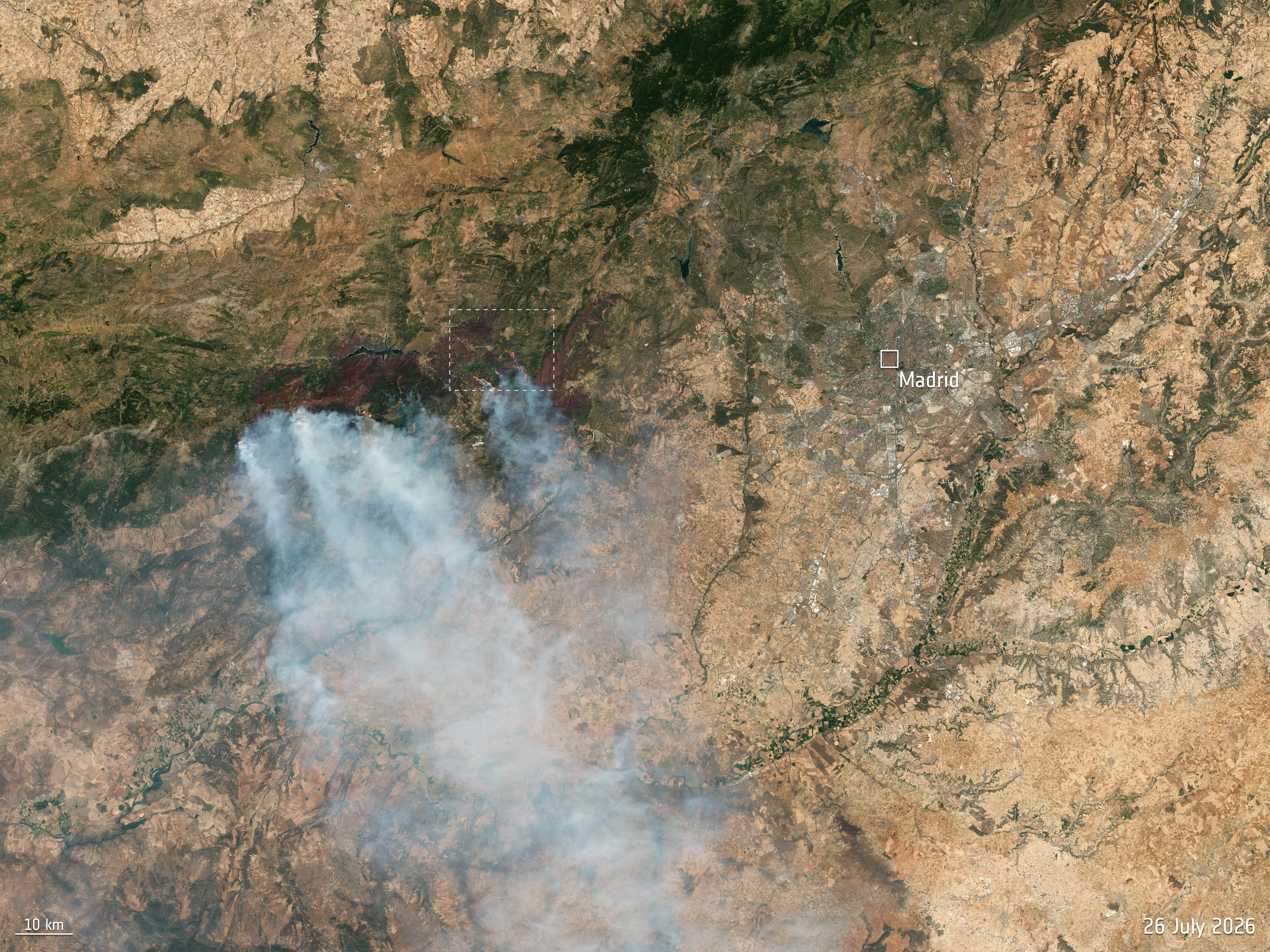
The European Union’s Copernicus Emergency Mapping Service was activated on 23 July to monitor and provide emergency mapping data on the wildfires in central Spain.
The Sentinel-2's near-infrared channel has been used to highlight the active fire fronts. Each of the Sentinel-2 satellites carry an innovative wide-swath, high-resolution multispectral imager with 13 spectral bands for a detailed view of land and vegetation.
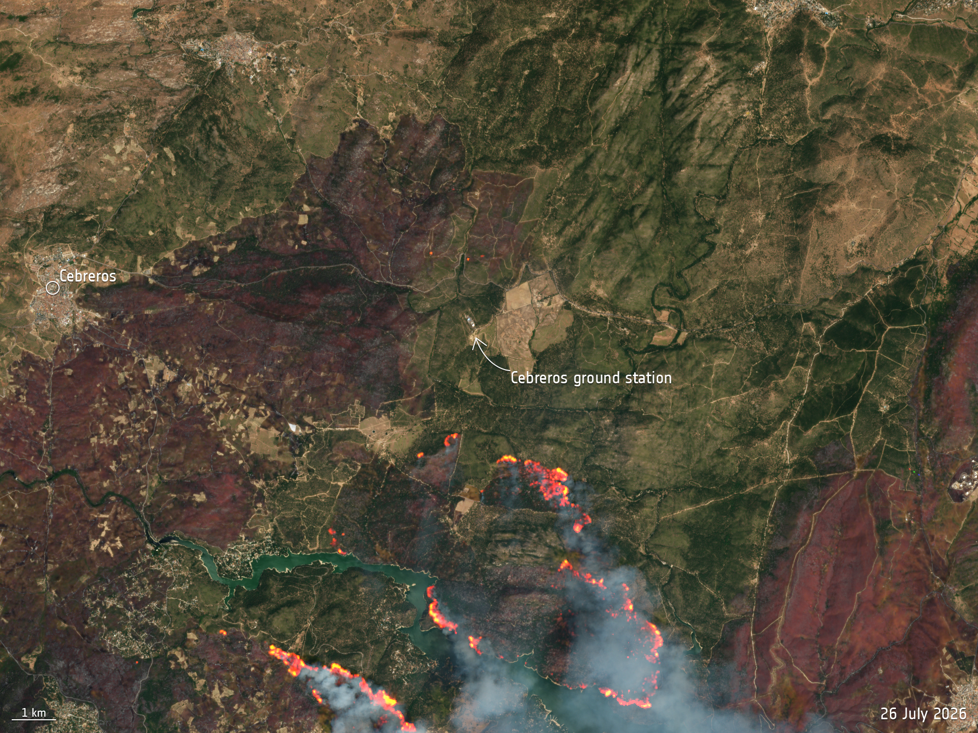
A zoomed-in view over ESA's Cebreros ground station – see area marked – was also captured by Sentinel-2 on the same day. See below:
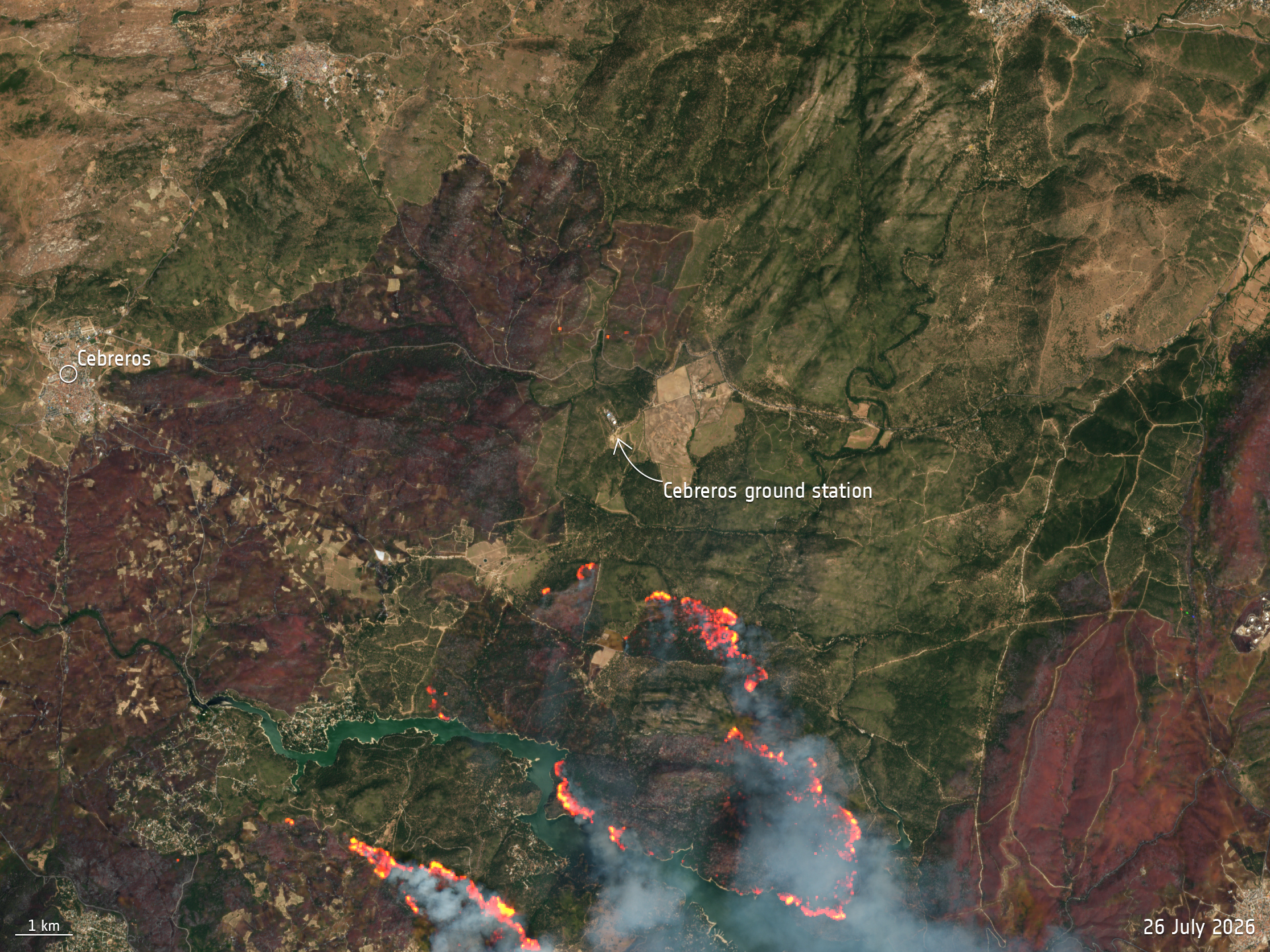
This Copernicus Sentinel-2 image, captured on 26 July, shows a zoomed-in view of the Cebreros ground station, west of Madrid, Spain.
Cebreros ground station, 77 km west of Madrid, hosts a 35-metre antenna and provides routine operational support to ESA deep-space missions, such as Mars Express, Gaia, BepiColombo, Solar Orbiter, Juice and Euclid.
It also supports missions for other space agencies under resource-sharing agreements.
As of the morning of 27 July, ESA reviewed the situation at the Cebreros station and declared it safe for nominal operations.
This Sentinel-2 image uses true colour overlaid with false colour to highlight the active fire fronts. Each of the Sentinel-2 satellites carry an innovative wide swath high-resolution multispectral imager with 13 spectral bands for a detailed view of land and vegetation.
Login and start learning!