Remote Sensing
Earth from Space: Kimberley, Australia
This week we look at different combinations of Sentinel-2's spectral bands to highlight different features of Australia's Kimberley region
Western Australia’s Kimberley region is featured in this double view from the Copernicus Sentinel-2 mission.
The area pictured is part of Kimberley’s western coastline along the Indian Ocean. The large inlet on the left is King Sound – a gulf measuring about 120 km long and 50 km wide. King Sound has the highest tides in Australia, and amongst the highest in the world, reaching a maximum range of around 11 to 12 m.
View the two images below:
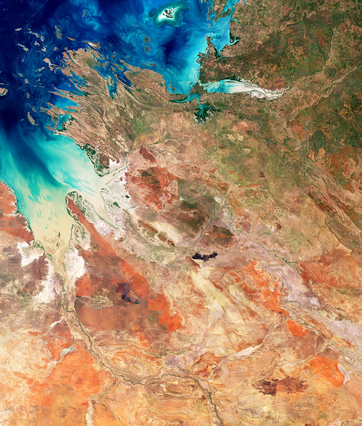
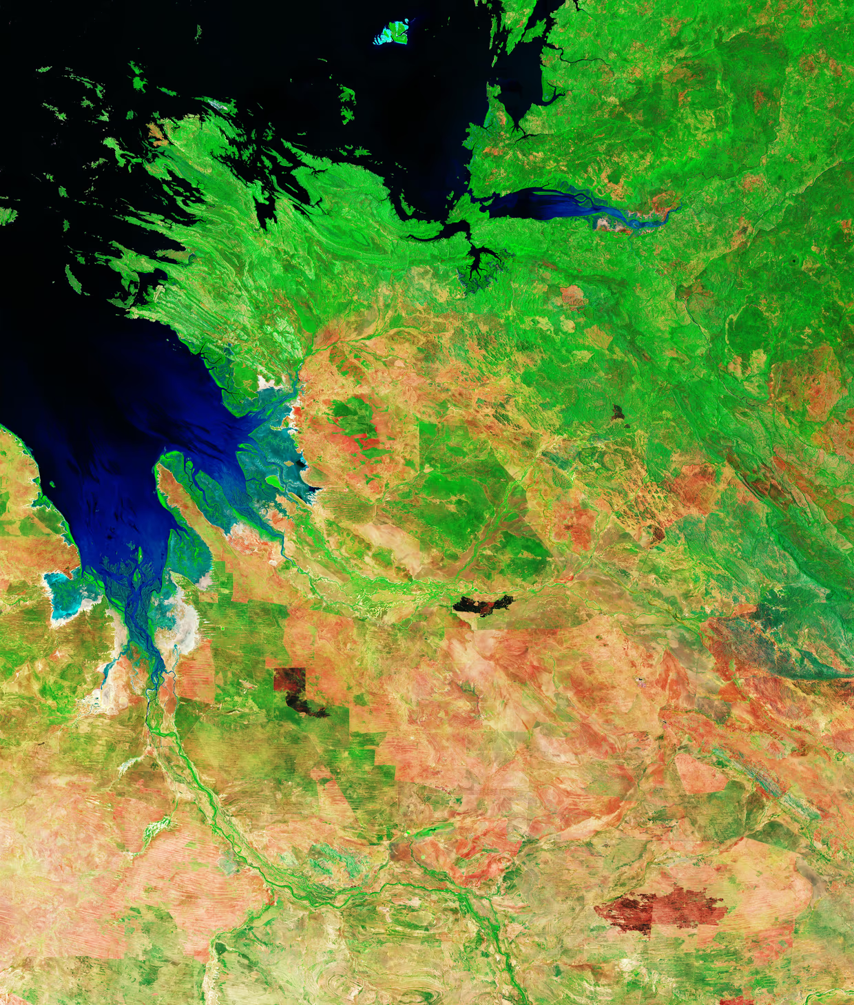
Several rivers empty their muddy and sediment-laden waters into the sound. Among these, the Fitzroy River, flowing from the bottom centre of the image, is one of Australia’s largest watercourses. The port town of Derby lies near the mouth of this river on the western shore of the smaller peninsula jutting out into the sound.
Acquired in December 2025, these two views use different combinations of Sentinel-2’s spectral bands: the image on the left is in natural colour, as the human eye would see the area, while the image on the right has been processed in false colour to highlight specific features.
A myriad of mangrove estuaries are scattered around the coast, which in the left-hand image are partially concealed within the large expanses of tidal mud flats. The false-colour view allows the mangroves to be easily distinguished as they appear in neon green, which indicates how dense and vital the mangrove forests are. This is particularly important, as mangroves contribute many environmental benefits to coastal and estuary ecosystems and protect the coastline from erosion.
Check out this Geoversity article on Five Benefits of Mangrove Forests to learn more.
Owing to the presence of sediment carried by river discharge, the water in King Sound appears brownish in the left image, also suggesting shallow water. In false colours, the water shows up in black and blue hues, which reveal deep water with blue denoting a higher concentration of sediment on the surface.
The hinterland visible in the images is a transition zone where grasslands gradually give way to the arid deserts further south in Australia’s vast and remote interior. In natural colours, the landscape is dominated by sparse green vegetation and the deep ochre and rusty red of the soil – this is known as pindan soil, which is rich in iron oxides and is typically found in the south-western Kimberley region.
In this view, the natural red of the soil can sometimes hide burn scars, while in the false-colour image they are clearly visible as dark patches on the land.
The ability to identify areas burnt by wildfires is a valuable resource in regions such as this one, prone to fires, as it allows authorities to better track the frequency of fires, map the extent of the burned areas and evaluate the impact on the surrounding environment.
Login and start learning!