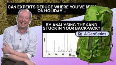
Mineral Exploration
Sample preparation for the XRD Scanner - an unique look behind the scenes
7:10
Geological remote sensing is an extremely effective tool for defining target areas for exploration and mining. In this article, we will trace the evolution of satellite remote sensing and discuss the most popular sources of freely available data. We will also investigate the impact of developments in remote sensing on exploration and mining and conclude by taking a brief look at things to come.
Geological remote sensing, in essence, is about light interacting with matter – in the case of exploration and mining, this interaction generates certain characteristics in the light reflected by rocks and minerals. To understand these characteristics, researchers use different types of sensors. Depending on the design specifications of these sensors they will get different bits of information. It's usually a trade-off between the size of the pixel and the number of channels covering the electromagnetic spectrum. A larger pixel size generally means less information per pixel, whereas more channels give a more detailed signal.
Geological remote sensing allows researchers to create a chart of the reflectance percentage (the amount of light reflected after interaction with the surface) versus the wavelength position in the electromagnetic spectrum. Within the spectrum, the visible part of light is around 400 to 650 nanometres. For exploration and mining, however, the 2200 to 2400 nanometres range is much more interesting. In this wavelength range, certain minerals generate diagnostic responses. Looking at this longer part of the spectrum allows for identifying those diagnostic responses in such a way that minerals in a target area can subsequently be characterized and mapped. This process results in maps that will accurately show the surface mineralogy and its spatial distribution.
For over five decades now, satellite sensors have played a major part in acquiring valuable information for exploration and mining. The first generations of satellites were fitted with multispectral sensors. They capture a few specific, broad wavelength bands of light (usually visible and near-infrared) and provide basic information about the Earth's surface, like identifying vegetation, water, and urban areas. This is like using a camera with a limited number of colour filters. In later generations, hyperspectral sensors were introduced. They capture light in many narrow, contiguous channels and can detect a vast array of unique colours, allowing for highly detailed analysis.
The Landsat programme was the very first initiative geared towards gathering satellite imagery of Earth. The Landsat 1 satellite was launched in 1972 by NASA and USGS (United States Geological Survey). The latest addition to the range, Landsat 9, was launched in 2021. The acquired images can be viewed through the USGS "EarthExplorer" website.
The main use of Landsat 1-3 in geological remote sensing was the identification of iron oxides. These instruments had only four channels, located in wavelengths where the electromagnetic spectrum has features that are diagnostic for iron oxide. Identifying other chemical components, such as clays, would require looking at another part of the spectrum. If the sensor doesn't have a channel there, it will not detect the specific component. So the Landsat 1-3 image shows only the presence of iron oxide in a certain area, which is not to say that other components are not present. They are simply not detected. Later, Landsat 4-7 increased the number of channels to seven, and now Landsat 8-9 has eleven channels.
A lot of countries work with Landsat data because it's free and has many uses. However, the evolution of geological remote sensing took a giant leap with ASTER. Built in Japan in collaboration with NASA, ASTER was launched in 1999. It obtains high-resolution (15 to 90 square metres per pixel) images of the Earth in 14 different wavelengths of the electromagnetic spectrum. Scientists use ASTER data to create detailed maps of land surface temperature, emissivity (its effectiveness in emitting thermal radiation), reflectance, and elevation.
ASTER added several channels in the shortwave infrared range - a part of the spectrum where Landsat had only one. The shortwave infrared range is critical to understanding hydrothermal mineral deposits which are responsible for some of the most common commodities, such as copper, gold, and silver. This range allows researchers to generate much more information; instead of looking at just one point, there are five points in the reflectance chart. This has been a huge step forward in terms of the identification of mineralogy. For instance, besides allowing to map the presence of clay minerals as Landsat can do, these extra channels make it possible to identify the specific type of clay as well. After its launch all those years ago, ASTER is still capturing data. However, as the short-wave infrared is no longer functioning, the recently acquired data is not very useful for exploration and mining anymore.
Landsat and ASTER have been the main drivers of remote sensing for quite some time. Their data has been supplemented with hyperspectral datasets taken from aeroplanes or drones. These so-called airborne datasets provide much more information, e.g. on absorption features that are diagnostic for certain minerals. Multispectral satellite sensors will give information about a group of minerals that occur in a search, but they are incapable of identifying the exact type of mineral. Hyperspectral remote sensing changes that, by enabling researchers to differentiate minerals. A pixel no longer represents a mineral group but a mineral species. The information is much more detailed, and the spatial patterns are better defined. That being said, the coverage area of airborne data is much smaller compared to satellite sensors.
The increasingly urgent need for detailed information on large areas has led to a strong demand for satellite sensors able to provide such data. Up until recently, the only option on offer was WorldView-3, an ideally positioned superspectral sensor with a very high spatial resolution. To give an impression, whereas Landsat and ASTER have a 30-metre pixel (in the most commonly used part of the spectrum), WorldView-3's pixel is only 1.24 to 3.7 metres. This means the spatial resolution is ten times higher, which allows for amazing datasets to be generated. Unfortunately, WorldView-3 data is too expensive for education purposes or large-scale use in the global south.
Back to 30 to 60-metre pixel size, enter PRISMA, EnMAP and EMIT – a new generation of hyperspectral satellite sensors that made high-resolution data more accessible by offering it for free.
Launched in 2019, PRISMA is a hyperspectral imaging satellite, developed, owned and operated by ASI (Agenzia Spaziale Italiana). It features a hyperspectral camera module that covers a total of 237 channels. Its primary mission objective is the high-resolution hyperspectral imaging of land, vegetation, inner waters and coastal zones.
PRISMA was the first operational sensor of its (hyperspectral) kind. Its data is easily available. It's a matter of simply going to the website and selecting an area, and the data can be downloaded right away. PRISMA does have its complications in certain parts of the wavelength range, which makes identification of certain minerals difficult. But it's still usable, with 241 channels from visible to the shortwave infrared ranges.
EnMAP (Environmental Mapping and Analysis Program) is a German hyperspectral satellite that monitors and characterizes Earth's environment on a global scale. It was launched in 2022 to measure geochemical, biochemical and biophysical variables providing information on the status and evolution of terrestrial and aquatic ecosystems.
EnMAP's data is also freely available. To get EnMAP data for an area that is not being covered already, researchers need to first submit a mini-project. They will then have to wait until the data is acquired and made available. The quality of the data seems fine, with a high signal-to-noise ratio. It's all very new for now, but publications from researchers who have already worked with EnMAP data look promising.
EMIT (Earth Surface Mineral Dust Source Investigation) was developed by NASA and deployed in 2022. This hyperspectral instrument observes Earth from outside the International Space Station. Its mission is to map the mineral composition of arid dust source regions via imaging spectroscopy in the visible and short-wave infrared range.
As EMIT's primary purpose is to investigate dust sources, it will only cover areas where there's no vegetation most of the time. This means it has huge potential for geological remote sensing because, for geologists, vegetation cover is always a problem. EMIT has already yielded impressive datasets, which can be software processed into clear images in high resolution. The data is freely available on request through the same platform where ASTER and Landsat data can be acquired. The only complication is that up until now it has proven hard to process EMIT data into a final usable product. Normally, data from this type of platform is provided in a format that is immediately recognized by most processing software. EMIT data requires a lot of tinkering. Luckily, the most commonly used image processing software for geological remote sensing (ENVI by NV5 Geospatial) has already developed an import function for EMIT data.
For exploration, the advent of hyperspectral satellite sensors will mean improving the characterization of target areas. At the same time, there is a challenge ahead. These new information-rich datasets can be fed to models for machine learning and deep learning, and then AI will process them in a way that humans never could. However, most common users do not have access to the high computing capabilities required to process these amounts of data. They need datasets they can work with and still extract the necessary information. A combination of one hyperspectral sensor like PRISMA, EnMAP or EMIT with larger spatial coverage as offered by multispectral satellites might prove helpful. It could very well be that a clever combination of only several resolutions will allow the characterization and definition of target areas.
As for mining, up until now, the focus has been on finding easy deposits close to the surface. In the future, this industry will need to dig deeper and use more efficient methods to acquire the high quantity of metals required. These days a lot of attention is being given to lithium and rare earth elements for the chip industry. However, basic metals that are still part of our daily activities are highly critical as well.
Copper, for example, is essential for many things, including the energy transition. For instance, producing a fossil fuel car requires 20 kilos of copper, whereas 80 kilos are needed for an electric car. According to estimates, by 2028 there will no longer be enough copper available to meet the demand. Luckily, the wide range of sensors we now have available, including the new hyperspectral ones, will allow us to keep finding the metals we need.
To learn more about critical minerals, check out our article "Five minerals that can help to save the planet from the carbon crisis".
Hyperspectral satellite sensors are a recent asset. To reap all their benefits, we need to first understand the potential of these new sensors in terms of characteristics and other features. We also need to realize that hyperspectral datasets are much larger than multispectral ones. Processing these amounts of data will take more computing power than the average user has available on their laptop. So in the near future, we will probably see a rise in the use of server computing and supercomputers, with a major part to play for AI. Many algorithms are being developed for the automated characterization of certain areas. With this technology, it's only a matter of giving a model a few parameters and feeding it all available data, and the model will generate the classification. Of course, computer models will never get everything right. For some time to come, we will still need human geologists to make sense of the results that are generated.
Login and start learning!