Disaster Risk
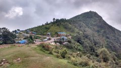
Rebuilding After an Earthquake in Nepal
3 min
This article introduces the Synthetic Aperture Radar tomography as a technique for providing a three dimensional view of forests structures beneath the canopy.
Synthetic Aperture Radar (SAR) tomography is a technique that provides a detailed three-dimensional view of forestry structures. It enables the observation and monitoring of the vertical structure of forestry, allowing for the characterization of the detailed flora beneath the forest canopy.
This advanced remote sensing technology revolutionizes our understanding of forestry by surveilling the vast diversity of plants beneath the canopy and revealing heterogeneous information about forestry from the ground to the top of the canopy.
The methodology of SAR tomography employs sophisticated mathematical algorithms and signal processing techniques to extract valuable insights into forest characteristics. At the core of TomoSAR is the use of multiple radar images captured from various viewing angles. This enables the creation of a detailed three-dimensional model of the forest canopy.
The high-penetrating signals of these radar systems usher in a new era of forest monitoring. Scientists can now delve deeper into the plant world beneath the canopy and scrutinize the vertical structure of vegetation with unparalleled accuracy. This technique contributes significantly to ecosystem monitoring and biodiversity assessments.
The applications of SAR tomography also extend beyond traditional research boundaries. This technology plays a pivotal role in disaster management, providing detailed structural information to assess the impact of natural events such as wildfires or deforestation.
For further details about this technology, explore the following research paper called Forest SAR Tomography: Principles and Applications
Login and start learning!