Climate Change
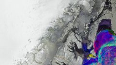
Earth from Space: Greenland's changing ice
4 min
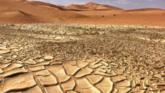
Droughts are a global problem affecting farmer communities that depend on rainfall for their livelihood. They occur due to changing weather patterns and are almost unpredictable without the use of advanced technology.
Meteorological droughts occur when there is a lack of rainfall in an area for a period of months or years. They can turn into agricultural droughts that severely endanger the livestock and crops that farmers and pastoralists rely on. They don’t know when a drought starts or how long it will last - this uncertainty is called “rainfall variability.” It's a phenomenon that takes place in many arid and semi-arid regions in Africa, such as Kapiti plains in the south of Machakos County, Kenya. This region is home to farmers and pastoralists who are highly dependent on crops and livestock for subsistence and commerce.
The well-being of the inhabitants of Kapiti Ranch is dependent on meteorological conditions, so predicting droughts ahead of time is crucial. The more information they have about a drought, the better they can organize ahead of time. For example, they could ask an organization for direct food aid. Or they may utilize agroforestry to mitigate the effects of the drought; the introduction of trees into the crops prevents desertification of the soil.
Predicting droughts is not easy but there are methods available. The main method involves forecasting the amount, duration, and timing of rainfall—water supply. However, the presence of rainfall does not mean that the drought is over; if the temperature is high, the water might evaporate before penetrating the soil. If the soil cannot hold the water, then the water leaves the roots before it is even absorbed. The flaws of this prediction method have prompted scientists to look for alternatives.
One such alternative involves accounting for the water actually used by vegetation—water demand, or as scientists call it, “evapotranspiration.” Evapotranspiration measures the amount of water evaporated from the surface and transpired through plants from the roots to the overlying atmosphere. The term is a combination of ‘evaporation’ (the process of turning from liquid into vapour) and ‘transpiration’ (release of water vapour from the leaves of a plant). Evapotranspiration describes the two processes, both of which move water from the land surface to the atmosphere.
Plants and the surface generally evaporate and transpire more water under normal growth conditions when there is more water available to do so. This is what makes it a better indicator of drought. If rainfall evaporated away, we would see a decrease in evapotranspiration and plants would suffer. The response of vegetation to drought can be detected from space with satellite imagery. Most sensors, however, are not sensitive enough to pick up small changes in evapotranspiration due to drought.
Hyperspectral remote sensing can be used to measure evapotranspiration in greater detail thanks to the narrowband sensors. Hyperspectral narrow bands are sensitive to a number of indicators of drought, including the amount of chlorophyll in the plant - an important pigment in photosynthesis - as well as soil moisture, vegetation height or biomass. Using these data, scientists can elaborate models to predict droughts with far more accuracy than with other methods.
Using hyperspectral information from the Italian Space Agency’s PRISMA hyperspectral platform and ECOSTRESS, a sensor on the International Space Station, ITC researchers are developing a drought monitoring tool to test at Kapiti Ranch. As part of an agile process, this tool will be presented to the researchers, technicians and decision-makers of the region. This project is developed with an EO Africa – Explores Expro+ grant from the European Space Agency along with the partners CNR-IREA, BOKU, University of Milano, and University Milano-Bicocca.
To learn more about the owners of Kapiti Ranch, visit the International Livestock Research Institute.
For more information, please contact Dr M. T. Michael Marshall.

Login and start learning!