Big Geodata
Is It Even Possible to Protect Your Data Anymore? Here’s What Works Personally and Professionally
6:04


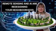
The increasing availability and processability of large datasets are transforming the field of research ethics. In the case of geoscience, it raises new questions about the way we build and manage cities, and distribute land and resources.
Geoscience scholars have a distinct responsibility. In this era of datafication and the introduction of new technologies into the field, their work—though laudable—can have negative impacts on people, groups, non-humans, and the environment.
It's important to be aware of the social and ethical implications of the new data-driven way of doing things.
Geodata is a peculiar type of data. Location data is sensitive because where you are is highly informative about who you are. If you visit three places in one day, the connection between those points in space is unique.
From information about, for example, someone's religious background, it's not as easy to know where they are at a given point in time. If you know where someone is, however, you can often infer a lot of sensitive information about them, including their religious affiliation, but potentially other information, such as their health.
Besides the fact that location can allow for a person to be identified, such information can get bundled into profiles - so-called digital doubles. These profiles are now being used to influence many aspects of our lives.
Privacy, both individual and group privacy, is clearly a major concern here, and this means there's a lot of responsibility attached to using these kinds of geodata.

Spatial patterns in the built environment develop over time and are often embedded in patterns of socioeconomic disadvantage and inequalities.
It's important to be aware of this when using geodata for decision-making.
Take, for example, the way that we move through cities. Some people might take the bus because it's cheaper; others might take the rapid transport train link because it's faster. These patterns of moving through cities differently link to structural differences and inequalities.
Now that geodata is being used increasingly as input for automated ways of routing people through cities, such differences and inequalities could be reinforced.
In addition, geo applications may have effects on the livelihoods of different strata of society – like, for example, if an automated rubbish collection system threatens the livelihoods of individuals who scavenge for recyclables to make a living.
Paying attention to the broader implications may uncover that just because it's technically possible doesn't mean it's socially desirable.
Data is made available to many different stakeholders for building useful applications, e.g. for navigating the city or getting the right bus in the right direction.
But access to all that open data can also give certain actors in the city an advantage. Large commercial actors might already have extensive profile information on the people in the city that they can combine. Other actors may not have access to the same type of information.
In this sense, geodata technologies can engender new power relations.
For instance, gentrification can have a positive impact on the urban economy but, at the same time, can also have a detrimental impact on less advantaged urban populations. If this is left to automated processes that powerful actors are more likely to have access to, ethical concerns will soon arise.
Geodata can include the growing amount of data that we produce as a by-product of our day-to-day activities with our phones, as well as image data collected by drones and satellites.
All this data is used to build an increasing flow of new technologies, which are located within different infrastructures. As a result, there's a growing number of interconnections between data suppliers and data infrastructures to be considered when using geodata.
Modern geotechnology experts should be taught how to recognize the importance of thinking about the kinds of technologies that they are developing, the kinds of interconnections, and the impact they may have on society.

It's important that geoscientists learn not only how to identify problems of technical optimization and how to make a model operate better but also to question the underlying ideas.
This picture is made more complicated by the question of how to formulate the values at stake. A lot of theoretical formulations have taken place in a northern context. So, how do we approach applying these values in a global context?
Quite often, the idea of being able to simply scale technologies can be problematic from an ethics standpoint because certain applications simply might not work as well in a different context. They may even have unintended harmful consequences.
A professional code of ethics for geotechnology experts has been in place for years, but following a code of ethics in itself isn't going to make researchers and practitioners behave ethically. It's also a matter of professional attitude.
A truly ethical approach requires taking the time to think through the project one is developing. Where might it be leading, and what implications could it have?
These deliberations can then be used to set up the project in a responsible way and to repeat those deliberations throughout the geodata project life cycle. We can design more ethical research, but such deliberation is still necessary, as it's not possible to create an ethics-proof project without regularly reviewing project ethics.
Geoversity is actively fostering learning that takes the above considerations into account. To share the knowledge of many experts working at the cutting edge of geodata technologies, we have now also created a dedicated online geotechnology ethics course, titled "GeotechE: Geotechnology Ethics".
The course aims to present theoretical base issues derived from critical data and technology studies – more specifically, critical geo(data)technology studies. GeoTechE: Geotechnology Ethics engages learners in thinking about these issues, drawing on bespoke learning activities and ethics case studies. The latter is used to highlight ethical issues specific to the kinds of work that ITC students and other geospatial specialists do.
As a MOOC – a massive open online course - GeoTechE is freely available and the perfect start to a more ethics-aware geoscience.
Login and start learning!