Artificial Intelligence
Monitoring urban forests using deep learning
6 min
Urban forests can help to mitigate many of the problems that cities are facing. A study investigated how deep neural networks (DNNs) can help us monitor these forests.
Cities provide all kinds of resources, facilities, education, and job opportunities. No wonder, then, that half of the world's population lives in cities. According to forecasts, by 2050, two-thirds of all people will live in urban areas.
Ongoing urbanisation puts a lot of pressure on cities and their infrastructures. Moreover, cities are responsible for about 75 per cent of carbon dioxide emissions and thus contribute to global warming and climate change.
Research suggests that urban forestry can be used as a nature-based solution to mitigate the problems cities are facing. Urban forests are thought to contribute to general health and well-being, sustainability, climate action, and biodiversity, as defined by the United Nations Sustainable Development Goals (SDGs).
Monitoring urban forests is therefore crucial in light of the SDGs. A recent study investigated how deep neural networks (DNNs) can serve this function.
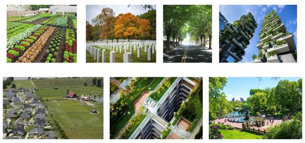
Urban forests include urban gardens, trees in cemeteries, street trees, vertical forests (or green walls), urban agriculture, green roofs, and urban parks.
Urban forestry is about making trees and green spaces in and around our communities deliver maximum physiological, aesthetic, economic and sociological benefits. Some of these benefits include:
All these benefits combined make monitoring and protecting urban forests a crucial task.
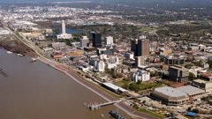
The study mentioned above was conducted in Baton Rouge, the capital of Louisiana, USA. It's common knowledge that Baton Rouge's urban forests are prone to fragmentation these days as a result of, for example, urbanisation, natural disturbances, rising temperatures, and invasive species.
This tendency makes efficient management of urban forests all the more crucial. Unfortunately, there is no time series data available that could show how much urban forest cover is being lost over time.
The study's main objective was to get a DNN to map the changes in urban forest cover, comparing 2018, 2020, and 2022.
To do this, the DNN model was given high-resolution satellite images provided by the PlanetScope satellite constellation. The study area encompassed parks, botanic gardens, the city's two university campuses, the local airport, the Louisiana State Capitol, and the Exxon Mobile refinery.
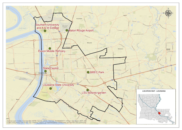
Study area
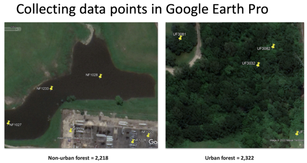
Training samples for the research were collected using Google Earth Pro in the form of over 4,000 points representing urban forest areas (UF) and non-urban forest areas (NF).
These points were imported into Google Earth Engine to save them as assets. Subsequently, satellite images for May 2018, May 2020 and May 2022 were downloaded from planet.com.

Left: sampled points evenly distributed across the study area. Right: a four-band PlanetScope image for May 2022.
In the next step, all this data was moved into Google Colab, the virtual machine platform where DNN models can be created, trained, and evaluated. The model was also stored in the Google Cloud AI platform for prediction in Google Earth Engine.
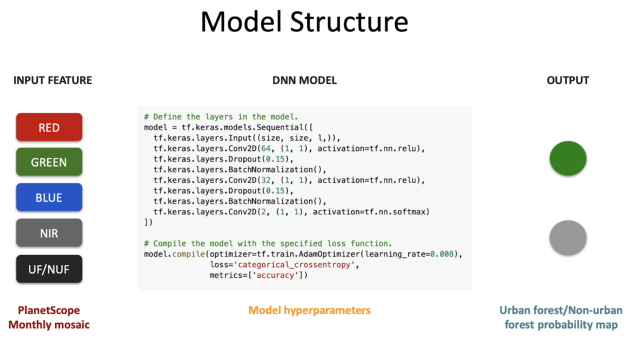
Model inputs: red, green, blue, and near-infrared sample points, as well as UF/NF labels. Model output: urban forest probability map.
The video below shows the model’s predictions in relation to the PlanetScope imagery:

The green areas represent the predicted urban forest areas; the grey ones represent the non-urban forest areas. The prediction turned out to be quite accurate at 85 percent.
This time series shows the changes identified in the land cover in the downtown area of Baton Rouge:
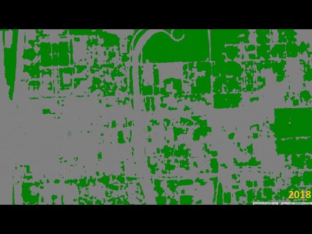
In 2018, the urban forest had a cover of close to 60 per cent; in 2020, it had reduced to about 52 per cent, and by 2022, about 50 per cent remained.
The study showed that Baton Rouge's urban forest areas gradually give way to the grey infrastructure. Between 2018 and 2022, the city lost about 9.9 per cent of its urban forest cover.
The study also confirmed that DNN models can be used to categorize complex landscapes and reveal patterns, trends and temporal differences. PlanetScope images were very useful for spatiotemporal analysis because of their high pixel resolution.
Further studies can be done to investigate the main drivers of forest cover change. This analysis's results can support decision-making aimed at achieving a sustainable city.
We also want to incorporate other indices, like Normalised Difference Vegetation Index (NDWI), to improve the model's accuracy.
Other possible areas for future research are estimating the carbon storage potential of Baton Rouge's urban green cover and predicting the extent of the urban forest cover for 2030 to further facilitate planning and decision-making.
This article was written by a former employee of NASA SERVIR.
Login and start learning!