Food Security
Is this the farm of tomorrow?
5 min
ITC researchers, in association with a number of specialized partners, created a dedicated insurance solution for smallholder farmers whose business is at risk due to the effects of climate change. The solution, dubbed the Vegetation Index Crop Insurance (VICI), is based on remote sensing technology.
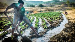
Farming is a risky business, especially for today’s smallholder farmers in rainfed systems. Due to climate change, they are increasingly exposed to drought and other weather-related risks. Many of them are reluctant to really invest in their livelihood for fear of losing their crops. To make matters worse, affordable insured credit is rarely available. It all results in low and stagnating productivity.
The above situation calls for a well designed drought peril insurance aimed at:
• protecting farmers against their potential inability to repay credit
• increasing smallholder access to finance
• enabling better use of inputs for higher productivity
• stabilising income (hence, stimulating willingness to invest)
In developing VICI, the researchers faced several major challenges:
• The insurance should not be a hidden subsidy model. It must be self-sustaining, with affordable premiums that do not depend on government funds. At the same time, the insurance should be aligned with government strategies associated with rural finance.
• Instead of insuring yield, the solution should facilitate pre-season investments by insuring agricultural credit. Credit insurance means that farmers can take more risk in investing.
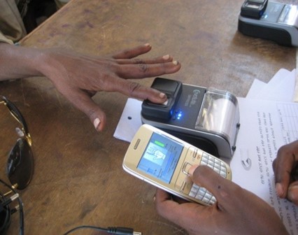
• The insurance should be such that it can be “invisibly” bundled in existing credit schemes, and even benefit from branchless banking technology.
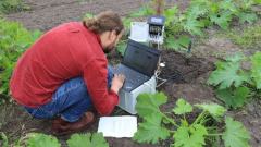
• Actuaries typically need more than 30 years of historical records to create sound insurance models. From a remote sensing perspective, such long timeseries are hard to obtain where the aim is to have regular observations of vegetation condition in a particular pixel (representing one or more parcels of agricultural land).
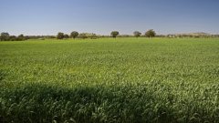
VICI is based on long term timeseries of Normalised Difference Vegetation Index (NDVI) data from European Space Agency satellites. NDVI offers an excellent representation of how vegetation responds to drought, including information on the timing, duration, and intensity of drought. NDVI can thus be used to assess the impact of drought on crops. From this, NDVI drought threshold values can be determined that should result in an insurance pay-out being triggered, with higher pay-outs for more intense and/or longer duration droughts.
However, as drought is a rare event, it’s hard to establish sample statistics as a basis for threshold values. This precludes the use of “deviation from normal” as an indicator of drought. The historical NDVI values of a single pixel will not provide enough drought observations to generate information statistically robust enough to be used in an insurance business model. That’s why the NDVI thresholds need to be based on population statistics instead of sample statistics.
Fortunately, remote-sensing and landscape ecology principles provide the answer to this problem. Population statistics can be generated by considering that the landscape is composed of zones within which similar patterns of vegetation and climate can be observed. These zones can be determined and mapped by using so-called unsupervised classification of NDVI timeseries. The zones can than serve as a basis for generating robust population statistics within each zone.
The short animation below shows NDVI throughout the year in Ethiopia, and the inherent spatial and temporal patterns to be observed.
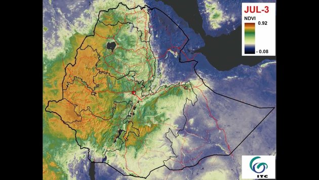
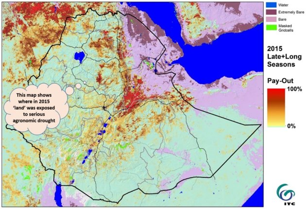
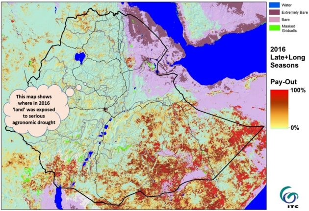
VICI was first developed and applied in Ethiopia. The images below show how VICI captured the extent of the severe 2015 and 2016 droughts in parts of the country.
In 2019, the Index-based Crop Insurance Project in Ethiopia (ICIP) included VICI in their Resilience Enhancement Package (REP). VICI was coupled with credit provision and agricultural advice, with a comprehensive training package being offered to farmers and agents in selected districts. ITC continues to provide remote sensing specific support. However, the ongoing civil war in Ethiopia means that deployment of VICI has remained limited to the Oromia region for now. This is unfortunate, because VICI has been deliberately based on scalable technologies, and the societal problem it addresses – drought – is prevalent in many other regions as well.
VICI was initiated as a Public-Private Partnership between ITC (University of Twente), Kifiya, and the Ethiopian Public Financial Enterprise Agency (PFEA), National Meteorology Agency (NMA), and Agricultural Transformation Agency (ATA). The initiative was funded by the Netherlands Space Office G4AW programme. Ongoing co-development and up-scaling take place within e-shape, which is a Horizon 2020 research and innovation project aiming to deliver earth observation-based benefits to a wide range of stakeholders. The partners here are ITC, IIASA (Internationale Institute for Applied Systems Analysis), Mekelle University (Ethiopia) and VITO.
Login and start learning!