- Geohealth
A novel spatiotemporal approach to COVID-19 surveillance
A recent Master’s thesis explored a new way to understand the spread and possible control of COVID-19 better by combining wastewater measurements and other epidemiological indicators.
Past research in wastewater-based epidemiology has shown that collecting and analysing wastewater can improve the surveillance of diseases such as norovirus, poliovi…Ottevanger, M. 4 min
- Artificial Intelligence
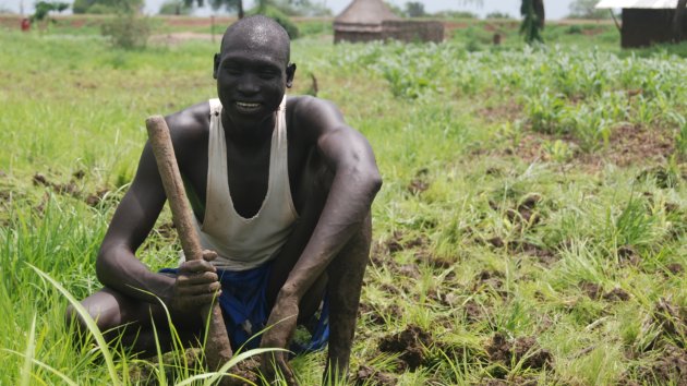
Four popular sources of labelled data for machine learning
In remote sensing, machine learning models are powerful instruments for classifying land cover and land use, identifying vegetation cover, determining soil types, detecting changes in the landscape, and more.
However, these models need to be fed labelled data as training material for optimum performance. This data type allows machine learning mode…
Paris, C. 5 min
- Digital Twins
Digital twins can make mapping easier and more accurate
A digital twin is a digital replica of a particular physical object, environment and/or event. In the field of geoinformation, the con…
Oude Elberink, S.J. 5 min
- Food Security
Impact and lessons learned from the GIACIS project
In another article, we described the VICI product and what made it unique. Read about it here: How geodata-based insurance can help smallholder farmers cope with weather risks.
In this article, we'll discuss some of the impact and lessons learned from the project.
Introduction
GIACIS has been successfully implemented in Ethiopia and there are ef…Chemura, A. 5 min
- Disaster Risk
Ethics and disaster management
Disaster management is a complex construct of sensible precautionary measures, effective action and responsible follow-up. As many dif…
Ottevanger, M. 8 min
- Geohealth
Why schools should have WASH – and teach it too
The COVID-19 pandemic confirmed how crucial access to adequate water, sanitation, and hygiene (WASH) services is for controlling infec…
Ottevanger, M. 6 min
- Natural Resources Management
How camera traps benefit Javan leopards
All over the world, large carnivores face diminishing prey populations. This is a serious concern, especially in the case of apex pred…
Ottevanger, M. 6 min
- Energy Transition
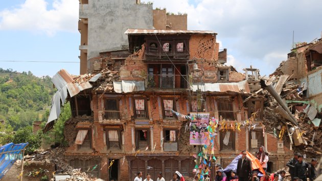
Are we running out of raw materials for the energy transition?
Europe faces various choices and challenges in terms of mining and the availability of raw materials. The 2023 European Critical Raw M…
Dijkstra, A.H. 7 min
- Disaster Risk
Predicting floods in real time
Fastflood.org is a real-time simulation platform that achieves about 97% accuracy in predicting floods while being about 1,500 times as fast. It provides an instant flood forecast for the selected area.
Highly accessible
During the development phase, the researchers noticed that many people were very impressed. However, usability was an issue, as…4 min
- Geohealth
Water, health and decisions: the impact of extreme weather
The United Nations Sustainable Development Goal (SDG) number 6 states that every person on earth should have access to water and sanitation, whereas SDG #3 stipulates good health and well-being for all at all ages. Both goals are clearly interrelated, as positive WASH (water, sanitation and hygiene) conditions can promote human health.
However, di…Ottevanger, M. 5 min
- Remote Sensing
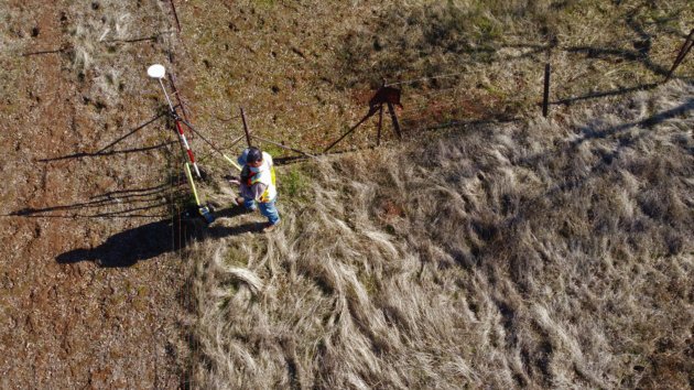
The Remote Sensing Data Labelling Challenge
Remote sensing involves analysing vast amounts of Earth Observation (EO) data, typically acquired from satellite data, aircraft or Unmanned aerial vehicles (UAVs). Machine learning models can be trained to assist here, by automatically classifying land use and land cover, identifying vegetation cover, determining soil types, detecting changes in t…
Paris, C. 7 min
- Land Administration Systems
New routes to affordable land administration
According to estimates, 70% of the world’s population cannot access a legal land administration system. This often makes it hard to determine which land belongs to whom. It also causes problems in vital areas such as productive farming, urban planning, and sustainable development. That’s why the UN incorporated the formal registration of property …
4 min
- Mineral Exploration
The evolution of geological remote sensing in mining and mineral exploration
Geological remote sensing is an extremely effective tool for defining target areas for exploration and mining. In this article, we wil…
12 min
- UAV
Improving road and traffic monitoring using drones and AI
Resilient roads keep our society and economy going, but taking care of them is getting tougher because of climate change, old infrastructure, and more traffic. Fixing them up costs a lot, especially since many are already past their prime. Monitoring how they're doing is super important to …3 min
- Disaster Risk
What is dynamic landslide susceptibility?
Why is a dynamic approach to landslide susceptibility important?
Landslide susceptibility is basically the probability of a landslide occurring. Obviously, the probability of a landslide occurring on a steep slope is much greater than on flat ground. That's something we can commonly perceive. However, by viewing this phenomenon as a dynamic proces…Mahnoor Ahmed 5 min
- UAV
How do UAVs help precision agriculture?
In this article, we discuss some of the benefits of using UAVs in agriculture, and how the technology has evolved
6 min
- Land Administration Systems
Establishing land rights by documenting land relations
5 min
- UAV
Five sensors that are used on smart agriculture UAVs
We've discussed in another article some of the ways that UAVs can be used in smart agriculture. In this article, we'll talk about some of the different data collection sensors that can go on UAVs.
1. Optical RGB. RGB (Red, Green, and Blue) sensors are the easy-access way – both financially and functionally – of getting high-resolution images. As …2 min
- UAV
Six ways that drones can make farming smarter
As the planet's population grows, so does the demand for food. “Smart agriculture” is a modern, more productive approach to meeting th…
4 min
- Sustainable Cities
Dealing with the challenges of modern urbanization
Over the last few decades, increasing numbers of people have moved to urban areas. This trend is far from new. In 1990, 43% (2.3 billion) of the world’s population lived in urban areas; by 2015 this had grown to 54% (4 billion). And it continues to increase. The United Nations predicts that, by 2050, the share of urban population will reach 66%.
A…3 min
- Sustainable Cities
Five new concepts of what cities should be
In another article, we described some of the challenges of modern urbanization. Urbanization is a phenomenon that often leads to prosperity, productivity and a better quality of life for many. It also often brings with it urban sprawl, environmental degradation, poor living conditions and severe problems of accessibility. Addressing such challenge…
3 min
- Sustainable Cities
How GIS technology can help to keep growing cities sustainable
Continued and increasing urbanization worldwide makes it ever more complicated to keep urban development sustainable. This is a serious task for urban planners and managers. To this end, modern GIS (Geographic Information System) technology has a lot to offer in terms of solution support. A GIS is an information system that integrates, stores, edi…
3 min
- Digital Twins
How a soil-plant digital twin can help predict and monitor our ecosystems for sustainable developments
Since 2018, the Netherlands and many other parts of Europe have been faced with increasingly long drought periods. To understand how ecosystems respond to such climate extremes, soil and plants need to be studied in a coherent way as one system that reacts to these events. ITC researchers surmise that a digital twin of the soil-plant system would …
4 min
- Planning Support Systems
Getting everything in place with the Matrix of Functions
Urbanization can be a positive force for the development of countries, in both urban and rural areas. But there may be problems in terms of regional development if people and resources are not well distributed. A booming town will soon get in trouble if it lacks skilled people or certain types of facilities, buildings and infrastructure. Similarly…
4 min


