- Artificial Intelligence
What are agent-based models?
Researchers seeking better solutions to the world’s problems need to test their ideas. Any given policy may have unintended consequece…
Schwarz, N. 6 min
- Food Security
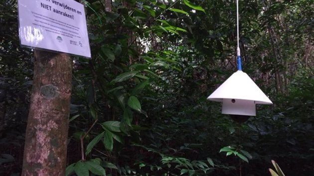
Mapping Rainforest Water Use: A UAV-Based Approach to Evapotranspiration
Tropical rainforests play a key role in regulating the Earth's climate, and a big part of this is through evapotranspiration (ET), which is how water moves from the ground through plants and back into the air.
Measuring ET can be challenging because most methods - such as eddy covariance or sap flux - are expensive or require a lot of work. These …
García, H. 4 min
- Climate Change
An army of egg-sized sensors to hatch a sustainable movement in Paramaribo
The concept of "adopting an egg-like sensor" isn't something that you hear every day. However, some residents of Paramaribo, the capital of Suriname, are now proudly calling themselves "egg parents". This refers to their involvement in the project Green Paramaribo - developed by Tropenbos Suriname and the ITC Faculty
In this story, we will discove…7 min
- Energy Transition
The Energy Transition Explained
Introduction
The energy transition that we are currently facing is by no means the first of its kind. It all began when humans mastered fire. The next energy transition came about with the domestication of animals that could transport things and do work that humans used to do. Then we went on to use combustion engines (1705) and nuclear energy (19…17 min
- Climate Change
What is overshoot day and why does it matter?
What is overshoot day?
Earth Overshoot Day marks the annual date when humanity has exhausted the supply of natural resources that Earth can regenerate within a year. It's an important date every year, as it represents the moment when we start using “borrowed” resources - that is, surpassing the ability of the planet to balance itself sustainably.…3 min
- Climate Change
How climate change is affecting food security in arid regions
Due to climate change, rising temperatures and shifts in precipitation patterns are exacerbating the intensity and duration of drought…
4 min
- UAV
Using drones to map forests and plantations
When mapping forests and plantations, scientists find many advantages in the use of drone technology. Learn about some of those advant…
6 min
- Natural Resources Management
Five benefits of mangrove forests
Asia, Africa, the Americas - the mangrove species can be found in tropical and sub-tropical areas worldwide. These trees, with their characteristic visible roots and low branches, are protected with pride by those who live around them. But what makes mangroves so special? In this article we are going to describe five main benefits of mangrove fore…
García, H. 3 min
- Natural Resources Management
What is eDNA?
Environmental DNA or eDNA is a technique used to detect and analyze genetic material left by organisms in the environment.
4 min
- Spatial Data Science
What is Spatial Finance?
The development of artificial intelligence is contributing to the field of geo-information science, with algorithms being developed to automatically scan and interpret this visual information. With the data from satellites and the insights from algorithms, we are able to access real-time observation of large-scale changes occurring on our planet. …
4 min
- Food Security
What is hidden hunger?
Hidden hunger is a popular term to refer to micronutrient deficiencies. Micronutrient deficiencies are a form of malnutrition caused by the insufficient uptake of vitamins and other micronutrients. This phenomenon is common in developing regions with cereal-based diets, but also increasing in developed countries, where individuals are opting for l…
4 min
- Water Resources
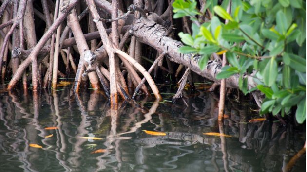
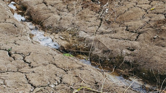
How water pollution affects shrimp farms
The Mekong Delta in Vietnam is one of the most biodiverse ecosystems in the world. It is home to mangrove trees, which absorb more CO2 than any other ecosystem. Mangroves are home to other species, such as fish, insects and shrimps.
The abundance of shrimp makes the Mekong Delta a key region for shrimp farming. This is one of Vietnam’s biggest in…
García, H. 3 min
- Spatial Data Science
Three dimensions to measure the impact of soil nutrients on the nutritional values of crops
When farmers need to know the nutritional value of a crop, the usual way to find out is by taking hundreds of samples of the grains into a laboratory and analyzing them. This process is not only very expensive but inefficient; the analysis is carried out at the final crop growth stage, when it is already too late for correcting nutrient concentrat…
5 min
- Remote Sensing
Remote Sensing to assess protein content in wheat - the secret to a perfect slice of bread
Embraced by fitness enthusiasts, proteins have claimed the spotlight in the field of health and nutrition during the last decade. Proteins are macronutrients, essential for the growth, maintenance and repair of tissues of the human body.
We can all name foods with high amounts of protein, such as tofu, broccoli or chicken. However, it's not comm…4 min
- Remote Sensing
How do LiDAR and radar Work?
Have you ever wondered how LiDAR and radar are used to map and preserve natural resources like forests? These two technologies are key tools in the realm of geo-information science, and they have several applications in natural resource management. In this article, we will take a closer look at how LiDAR and radar work and how they're used to map …
3 min
- Climate Change
Using hyperspectral remote sensing to predict droughts
Droughts are a global problem affecting farmer communities that depend on rainfall for their livelihood. They occur due to changing we…
5 min
- Climate Change
Climate Change as a Global Challenge
Climate change is one of the biggest global challenges of our times. All around the world, we see examples of extreme weather events …
28 min


